Skip to content Skip to main navigation Skip to footer

Author: Dan Ralley

How Gambier Allocated Its ARPA and CARES Act Funding

The Village of Gambier has invested in green energy and other infrastructure improvements with its American Rescue Plan Act allocation.

Gambier received $260,000 in ARPA money, half of it was received in 2021 and the other half arrived this summer.

Council has approved upgrading the water meter reading system for $80,000 to enable the Sensus meters to be read from the office, eliminating the need to drive around the village to obtain the readings. The system includes detection devices that attach to the fire hydrants in an effort to better identify leaks in the distribution system.

The village also spent $215,000 to install 94 solar panels at the wastewater treatment plant, using some
of its own utility funds to support the work that is scheduled to start in September. The village utilized a job contracting proposal through its membership in Sourcewell to undertake the project. McDaniels Construction is doing the build out in coordination with Third Sun Kokosing Solar.

When done, this will be the second solar powered system used in village facilities. A roof-mounted solar system was installed a few years ago on the Community Center and for the past two years it has generated more power in the summer months than what it takes to operate for former elementary school building that houses the village offices, a Head Start program and a library branch.

R.C. Wise, Village Administrator, said Council decided to do two large utility infrastructure improvements with the ARPA money in contrast to funding several initiatives in 2020 with the CARES Act allocation where they helped other private and public entities with the federal money allocated to it during the pandemic.

Gambier was awarded about $135,000 in the Coronavirus Aid, Relief, and Economic Security Act (CARES Act) and it was spent on public health, preventive measures, telework capabilities and economic aid.

Among the items, the Village spent:

  • $19,000 to install automatic door openers for both restrooms and the south exterior door of the Community Center.
  • $18,300 was invested in touch-free plumbing fixtures and water fountains in all of the village buildings.  $13,800 was spent on the Council chambers for improved social distancing and the installation oftechnology to allow for virtual and hybrid public meetings.
  • $41,319 was awarded to Area Development Foundation for them to hand out grants and/or loans toarea businesses that met certain qualifications.
  • $5,600 was spent on a partnership with Kenyon College to test and ship COVID-19 samples from thewastewater treatment plant influent, a project that continues today.
  • $5,100 was spent on improving interoffice communications and a community message board.
  • $5,000 was for a local business loan and hundreds more spent on personal protective equipment and air quality monitors.

Under the time restraints of the CARES Act, the Village referred nearly $13,000 of its allocation back to the County Auditor to help out other local government partners.

Megan O’Callaghan Named Dublin City Manager

Dublin City Council unanimously approved a contract with Megan O’Callaghan to be the next City Manager. O’Callaghan will assume the role on October 1, 2022. She will succeed Dublin’s fifth City Manager, Dana McDaniel, who will continue to work in an advisory capacity to further facilitate the transition until February 1, 2023.

O’Callaghan emerged as the top candidate after an extensive recruitment process. She has been serving the City of Dublin since 2014, when she was hired as the City’s public service director. She is currently the deputy city manager/chief finance and development officer, a position she has held since February 2021.

O’Callaghan says she is committed to fostering the culture of excellence in Dublin, ensuring that the City’s exceptional employees maintain world-class services

and amenities for Dublin’s residents and businesses. She is also dedicated to driving economic development in support of City Council’s visionary goals and to engaging with Dublin’s residents, neighborhoods, businesses and other community stakeholders.

“I am honored that Dublin City Council selected me to serve as the City’s sixth city manager,” O’Callaghan says. “Dublin is a vibrant and friendly city known for safety, inclusivity, innovation, economic vitality and natural beauty. As a resident and long-time employee, I am deeply committed to this community and have a vested interest in providing the best quality of life and environment in which our residents and businesses can thrive.”

Council unanimously approved a motion initiating contract negotiations with O’Callaghan at a special meeting held on August 2, 2022.

City Council began the nationwide search process earlier this year in preparation for the departure of current city manager Dana McDaniel, who announced his intention to retire after more than three decades of public service with the City of Dublin. Previous city managers include Tim Hansley 1987 – 2001; Jane Brautigam 2002-2008; Terry Foegler 2009 –2010, Marsha Grigsby 2010 – 2015 and McDaniel 2015 – present.

Tim Hansley Retires After 50 Years of Public Service

Tim Hansley, Union County Administrator, retired in June after over 50 years of public service throughout the state of Ohio. Tim began his career in public service with the US Coast Guard in 1968. In 1972, he began serving as management analyst for
the City of Cincinnati until 1974 before becoming the finance director for the City of Westerville. Tim then moved into a city management role for multiple Ohio Cities: Tipp City (1976-
1980), Lebanon (1980-1987), Dublin (1987-2001), Conneaut (2002-2004), Beavercreek (2004-2005) and City of Pickerington (Director of Development 2006-2008 and City Manager/Director of Development 2008-2009). Tim then moved on to serve as county administrator for Delaware County from 2010-2016 before being named Union County Administrator in 2017.

Tim formerly served as OCMA President, Past President,

Treasurer and Board Member, and was recognized by the International City/County Management Association (ICMA) for his career in public management at the

2019 ICMA Annual Conference.

In addition to holding many other leadership roles on committees, boards and associations throughout his career, Tim has provided countless individuals and communities with unmatched leadership, selflessness and a pragmatic approach to problem solving.

In retirement, Tim will continue to serve as a volunteer with the Dublin Police Department and Union County EMA. He will also take advantage of his newfound spare time by enjoying time with his partner, Anne, children and grandchildren as well as his favorite hobbies: traveling, camping, boating, and water sports.

Welcome to the 108th ICMA Conference in Columbus

Welcome to the 108th ICMA Annual Conference

On behalf of the Ohio City/County Management Association and our Conference Host Committee, thank you for joining us in Columbus/Franklin County for the 108th Annual ICMA Conference. We’re thrilled you’re here!

Columbus is the 14th largest city in the country and the fastest-growing city in the Midwest. You’ll love exploring the place that is known as one of the nation’s most creative, innovative and up-and-coming destinations. Celebrated for its incredible arts, entertainment, fashion and culinary offerings, exciting collegiate and professional sports teams and spectacular sprawling green space on the Scioto Mile downtown riverfront, Columbus/Franklin County has something for everyone.

Our Host Committee Members, 300+ volunteers and Certified Tourism Ambassadors will be present throughout the convention center, host hotel lobbies and Downtown Columbus. If you have a question, need directions or are looking for a suggestion … this energetic and committed team is ready to assist.

We invite you to join us throughout the conference in the Host Committee Lounge, located in the main hallway, as we showcase some of the best that Columbus/Franklin County has to offer…and yes, of course, we’ll have coffee, tea and snacks too! Photos with Brutus Buckeye, performances by the West African Dance Institute, live aerosol art with Lance Johnson, and a visit from the Columbus Zoo & Aquarium’s animal ambassadors are among the attractions.

And at the Arnold Plaza, just outside the Convention Center’s main High Street doors, you’ll get a chance to leave a bit of yourself and take a piece of Columbus/Franklin County home with you. Be a part of the art, and help paint our signature “One with US” mural designed by local street artist Miss Birdy, customize a t-shirt with Franklinton Press or DIY a personalized leather keychain with Makers Social.

The Host Committee Lounge showcases, food, beverages and Arnold Plaza participatory activities are all compliments of our Ohio Host Committee Sponsors. We sincerely thank them and encourage you to acknowledge our sponsor signage in the Host Committee Lounge, the Arnold Plaza and on the back of this letter.

On behalf of Team Ohio…we are thankful the world made the choice to be one with US in 2022.

R. Thomas Homan, ICMA-CM Host Committee Co-chair
City of Delaware City Manager

Charlotte Colley
Host Committee Co-chair Miami County Administrator

Robert Fowler
OCMA President
City Manager, City of Norton

Robert Fowler OCMA President 2022-23

Robert is currently the City Administrator in Norton, OH. Prior to Norton, he worked as the Safety Service Director in Lorain, Director of Administration in Wooster, and Village Administrator in Carrollton. He has served on the OCMA as the Chairperson of the Support the Profession committee, Vice-Chair of Membership Services and on the OCMA Board of Directors. He has serves on the 2022 ICMA Conference Planning Committee. Outside of the Office, Robert is an avid motorcyclist, golfer and officiates High School Football and Basketball.

A Golf Information System Saves Client Time and Money

Whether you play golf for fun or on a more serious level, or just admire the grass on the course as you drive by in your car, a golf course is the pinnacle of lawn care and maintenance. The quality and conditions of the greens and fairways are critical to your game.

Apart from a groundskeeper cutting the tee box while you’re putting on the green nearby, many of us don’t think about the maintenance of a golf course. The reality is that the upkeep of a golf course is very labor intensive and requires a high degree of management. Additionally, with a push towards sustainability, using technology for better management of resources is becoming a critical piece of maintaining a golf course.

So, what is Golf Information System? A Golf Information System is not a real software or solution, not yet anyways. It’s a fun play on words for the real GIS or Geographical Information System. GIS has been used in cities, counties, and states for over 20 years to organize and manage digital information such as parcel data, utilities, infrastructure, and other assets. GIS allows you to store digital data in a graphical format and allows users to add information or intelligence to the data.

Golf courses share some similarities with cities, on a smaller scale. They are required to manage golf course assets and resources such as vegetation, water and wastewater, pavement,

building/structure, equipment, and personnel. When the team from AJ Jolly Golf Course in Campbell County Kentucky approached us about challenges with managing their sprinkler valves and sprinkler heads, a GIS solution made sense.

Challenge

As part of our consultation, our discussion focused on two things: the challenges they had with maintaining their sprinkler system maps and knowing exactly where the valve controls were for each segment of the system.

The sprinkler system map started with a paper map that covered their entire 18-hole course and was created when the sprinkler system was installed in 1995, showing the location of the lines and heads on each hole. From that main map, sections of the golf course were copied to smaller more manageable sheets that could be taken into the field and used as a visual

guide for maintenance. It was a simple yet effective system that worked well for many years. These maps were used frequently, taken out on the course rain or shine, thrown in golf carts or placed in pockets to locate, adjust, and perform system maintenance (see Image 1). The maps became worn, torn, smudged, and sometimes lost,

Our client was looking for a more effective method for locating the valves and being able to quickly turn them off in cases of leaks, damage or just regular maintenance.

page17image50128848

so new copies of segments were made frequently, but without these paper maps, managing their sprinkler system would be nearly impossible.

For the valves, the golf course was interested in more precise locations. These valves sit at grade level or slightly below grade so they would slowly become hidden and buried, making them very challenging to locate. In maintenance situations, finding the valves took time, often required a magnetic locator and a shovel, and even then, you were not sure it was the right valve for the section that contained the leak. They were looking for a more effective method for locating the valves and being able to quickly turn them off in cases of leaks, damage or just regular maintenance.

Solution

The information on these maps was invaluable, and precisely locating the valves for future access was critical. Our plan was to combine all this data into one source, making a more permanent digital solution. We were also looking to create something easy to maintain, easy to update, and with the ability to use on a cell phone or tablet that could be taken into the field. With today’s GPS enabled devices, the ground crews could use the digital solution to literally drive a golf cart to the precise location of the valve or sprinkler head for maintenance.

The best and most effective method for creating and hosting the data was using ArcGIS. We decided on using ArcGIS Pro to develop the combined database and then ArcGIS Online (AGOL) for posting the final dataset. We were originally considering new aerial acquisition in support of the project, but we knew that Campbell County had recent aerial imagery acquired through Link-GIS that could be used as a back-drop for the AGOL final dataset.

Approach

The starting point for this project was to establish highly accurate locations for the sprinkler valves. The location of the valves was not only critical for the golf course’s use, but we would also use them to better scale the paper maps to fit real-world coordinates. CT’s survey team went out in the field, as the golf course staff did many times, with paper maps to roughly locate each valve. They then searched the area with a magnetic locator to find the head and carefully uncover it. The survey team also surveyed a few of the sprinkler heads to aid in the process. The valves and heads were then more precisely located using survey grade GPS equipment to measure the location to sub-foot accuracy.

Our next step in the process was to take the paper maps and harvest the critical information from them. As mentioned previously, there were two sets of maps, the main overall map of the entire system, and the smaller segments. We decided to digitally scan all available documents. As most of us know, scanning documents can present its own challenges, but when you scan documents that have been out in the field, crushed, folded, smeared and stretched, that can add a whole new level of challenge to the process. Upon completing the scanning, we also discovered we need to do a little color adjustment to the scans to bring forward the important information and soften the other marks such as mud and water stains.

Once the maps were scanned, the next step in the process was to move and scale the digital copies of the map into a more accurate geographical location to match real-world coordinates. This process was completed in ArcGIS Pro’s Geo-referencing tool. Mark Hammond, CT’s GIS expert, used the survey information from the valves and heads, along with landmarks on the paper maps, to more precisely locate them in real-world coordinates. Additionally, he was able to use Campbell County’s most recent aerial imagery as a back-drop for additional guidance.

page18image50130096

The scaled maps were then used to digitize the information to create symbols representing each point feature such as valves, sprinkler heads, and laterals. Those symbols were then connected with line work representing the various size water lines within the system (see Image 2.) With all the data now digitized in ArcGIS Pro, we now had a more geospatially accurate foundation of their sprinkler system for their entire golf course!

Adding Intelligence

The benefits of using ArcGIS for a project like this is the ability to add intelligence and information to the map beyond what the original hard copy data provided. The range of information you can add in ArcGIS is almost unlimited, but it comes down to what information is useful and what information can be maintained over time. Unfortunately, in many applications of GIS, too much information is added and tracked, and it becomes overwhelming for the client to maintain, so it is essential to manage expectations and needs as part of the consultation with your client.

CT reviewed what information was important to our client and what additional information they would like to track in the future. As mentioned previously, the paper maps had a wealth of information on them from the installer, including valve types and manufacturer, sprinkler head types and manufacturer, diameter and material of waterline, and even the length of the waterline. All this existing information was important to the client, so it was transferred to the new digital map. Additionally, we added a replacement date and notes field in the attribute table for future use.

The final product was loaded into an ArcGIS Online map for our client to use (see Image 3.) They plan to maintain and update the information on the map moving forward using both in-office and in-field editing capabilities.

Digital Golf Information Systems

For a long time, GIS has been looked at as a tool for large entities such as cities and counties, but in recent years the benefit of its applications has been realized for smaller entities. The idea of using GIS to help manage a golf course is long overdue. The game of golf has been moving in a digital direction for over a decade, bringing more intelligence to the players such as ball tracking, instant measurements of ball

location to pin, and more recently, intelligent golf carts with GPS and interactive maps. Now, GIS for management of the course and the intelligence brought to the golf game can play and live together!

Soon after the development of the final map, the data was used in real time when a tree fell on the course during a storm. The golf course manager was able to identify that the tree fell near one of the buried valves that was recently located through this process. That allowed the clean-up crews to stay away from the valve, reducing the risk of damaging it with heavy machinery. It was an early win for a system that will reap benefits for years to come.

Want to learn more? Contact: Joe Cantz. CP, SP, GISP | 440-530-2328 | jcantz@ctconsultants.com
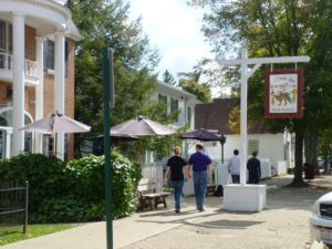
Gambier Celebrates 43022 Day

What’s a town to do when the calendar coincides with its assigned zip code? In Gambier, that was a sign to have a celebration to mark the once in a century occurrence which happened on 4-30-22.

Kenyon College and Gambier collaborated to host a 43022 Day party on Middle Path that Saturday morning which included a parade, a planting, a poem and a proclamation.

The college bookstore had offered special shirts and other swag for sale and handed out free vouchers for the food trucks. Gambier gave away unique coffee mugs to the first 250 attendees and printed up commemorative postcards pictures of the Post Office circa 1940.

Councilmember Kaitlin Sockman designed the mugs and planned with Kenyon staff and students for the special day that also kicked off a redesign of downtown green space. Council President Morgan Giles planted a white dogwood tree at the northeast corner of the Post Office – a start of the revamp of the pocket park that lies between the Village Market and Post Office.

Council members Rakia Faber and Alison Furlong took the opportunity to poll residents’ views on “Reimagining Gaskin Ave”, one of the two downtown streets, on how to best include non-motorized traffic along the main artery.

Resident poet Royal Rhodes read the poem he created for the event. And no observance in Gambier would be complete without a proclamation from Mayor Leeman Kessler.

And with that, the parade stepped off and concluded the day’s scheduled events but villagers stayed downtown for food and fellowship for what most celebrants will witness once-in-a-lifetime: The day my Zip code and calendar were the same.

Elections Results

An election is a formal decision-making process by which a population chooses an individual to hold public office. Elections have been the usual mechanism by which modern representative democracy has operated since the 17th century.

Read More

Water Quality Report

Water quality refers to the chemical, physical, biological, and radiological characteristics of water. It is a measure of the condition of water relative to the requirements of one or more biotic species and or to any human need or purpose.

Read More

Discover Pressville

Tourism is travel for pleasure or business; also the theory and practice of touring, the business of attracting, accommodating, and entertaining tourists.

Read More